DISCOVER UGANDA
Hiking in Uganda
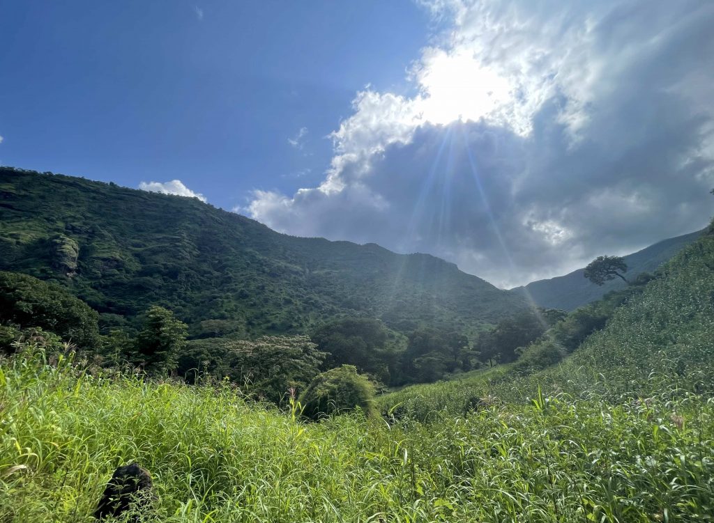
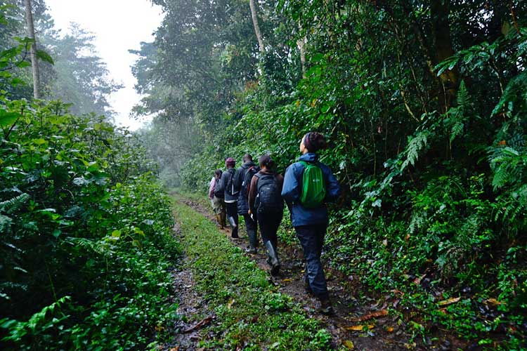
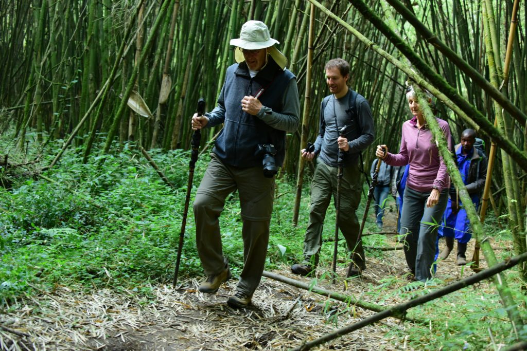
Hiking in Uganda is one of the most breathtaking Uganda safari tours appreciated by many travelers that visit the country. Whether you are a beginner hiker or a seasoned one, looking for an adventure or simply exploring, hiking safaris in Uganda are bound to meet your interests. With its spectacular scenery and year-round pleasant climate, Uganda is the perfect place to go hiking; from roaming the savannah plains and trekking through dense jungles to climbing up snow-capped peaks, the landlocked country has it all. The most adventurous mountain hiking adventures in Uganda are offered on the Rwenzori Mountains, Africa’s third tallest mountain, Mount Elgon – the world’s largest caldera, the Virunga Mountains of Mount Gahinga, Mount Muhavura, and Mount Sabyinyo, Mount Moroto, and Mount Morungole.
On the other hand, forest hiking tours in Uganda include Kalinzu Forest, Queen Elizabeth National Park’s Kyambura Gorge, Kibale Forest National Park, Bwindi Impenetrable Forest National Park, Budongo Forest, Mabira Forest, Mpanga Forest, to mention but a few. All in all, Uganda is a fine destination for Uganda hiking safaris, boasting an array of hiking locations; and all of these attributes have tremendously eased hiking in Uganda: hikers may find a range of hiking spots that offer both high and moderate altitudes to hike while on their safari hiking trips in Uganda. The following are the top hiking locations in Uganda;
Top Mountains for Hiking in Uganda
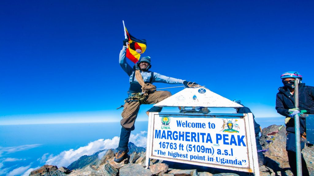
Table of Contents
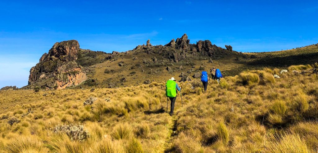
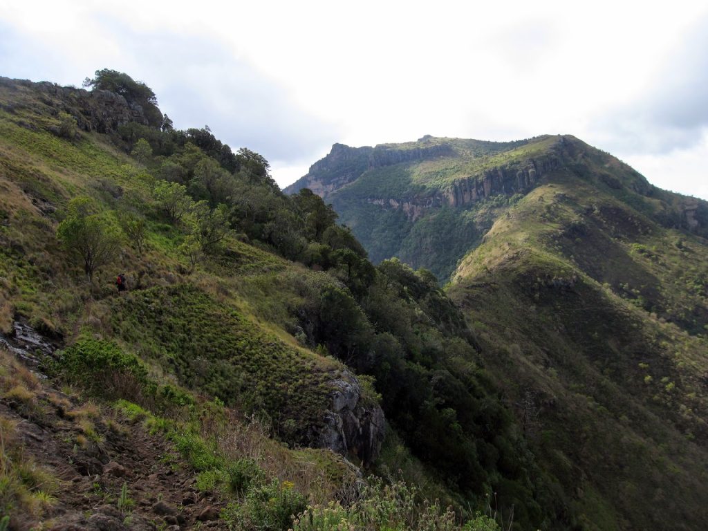
The Rwenzori Mountains
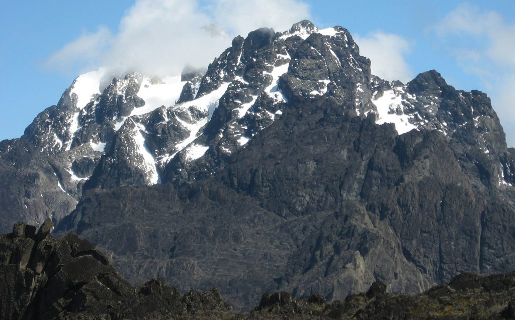
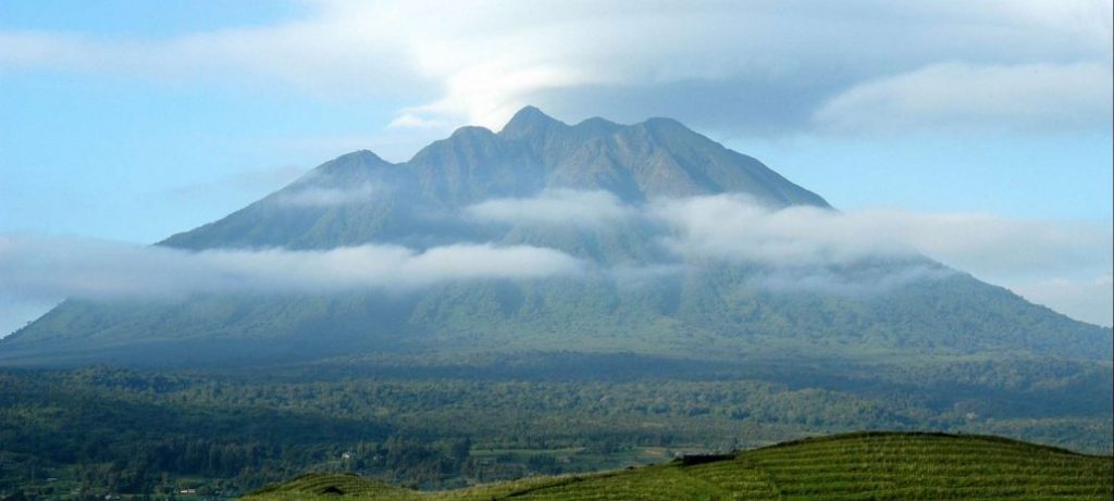
The Rwenzori Mountain Ranges, at 5,109m (16,752 ft) is the third-tallest mountain in Africa, located in western Uganda in Kasese District, on the border with the Democratic Republic of the Congo. The Rwenzori Mountains are some of the most hiked mountains in Africa, spanning 120 kilometers in length and 65 kilometers in width. Also known as the Mountains of the Moon, the magnificent ranges are a UNESCO World Heritage Site protected as the Rwenzori Mountains National Park and managed by the Uganda Wildlife Authority. Moreover, the famed Queen Elizabeth National Park, a top Uganda safari destination, lies a bit to the north of the mountain’s Ugandan section.
Formed about three million years ago, Mount Rwenzori is thought to have developed from an uplifted block of crystalline rocks made up of gneiss, amphibolite, granite, and quartzite. Hikers are drawn to its Margherita peak, which stands the highest (5,109 m), and the whole peak, as well as other top regions of the mountain, are wholly glaciated and covered in snow. The Rwenzori Mountain Range is made up of six massifs that are connected by large valleys: Mount Stanley (5,109m, 16,762 ft) and Mount Speke (4,843m, 16,040 ft) are the two tallest among them followed by Mount Baker (4,843m, 15,889 ft), Mount Gessi (4,715m, 15,469 ft) and Mount Luigi di Savoia (4,627m, 15,180 feet).
Mount Stanley is the tallest mountain in both Uganda and the Democratic Republic of the Congo, with its highest summit, Margherita. Mount Rwenzori features a spectacular landscape covered by striking vegetation and some of the largest glaciers on the continent. Several rivers fed by streams from the mountain range are one of the origins of the Nile River.
Uganda hiking tours on Mount Rwenzori are offered only on two spectacular and challenging hiking routes: the Kilembe trail which takes 9 days to ascend and descend. This trail summits to the Margherita Peak. The other trail is the central circuit trail which summits Elena Hut, offering panoramas of Margherita Peak and taking 7 days to complete. However, even hikers who are interested in shorter hikes can explore the Mahoma loop which will take 3 days to reach the peak, the 1-day chimpanzee trail, and the Kilembe trail which takes a day to conquer this magnificent mountain.
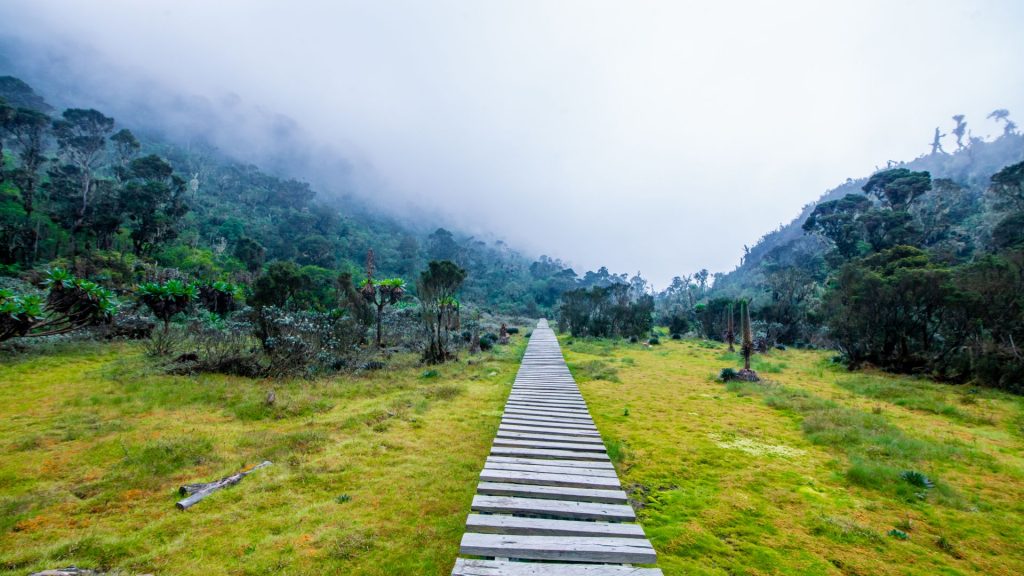
Hiking trips up Mount Rwenzori start from Nyakalengija, 22 kilometers west of Kasese District. Kasese is about 7 hours from Kampala and can be accessed both by road and air. Hikers will be treated to the best quiet, sparsely populated area of the country through the Rwenzori National Park.
The park is home to a plethora of wild animals, including forest elephants, forest hogs, leopards, African golden cats, sitatungas squirrels, and a variety of birds like sunbirds, robins, owls, bee-eaters, swifts, barbets, vultures, and eagles. The spectacular flora features wild and distinctive species including big lobelia, enormous groundsel, and tropical rain forest. Hiking tours on Mount Rwenzori can also be combined with gorilla trekking in Bwindi Impenetrable Forest National Park, wildlife viewing in Queen Elizabeth, or chimpanzee trekking in Kibale Forest National Park.
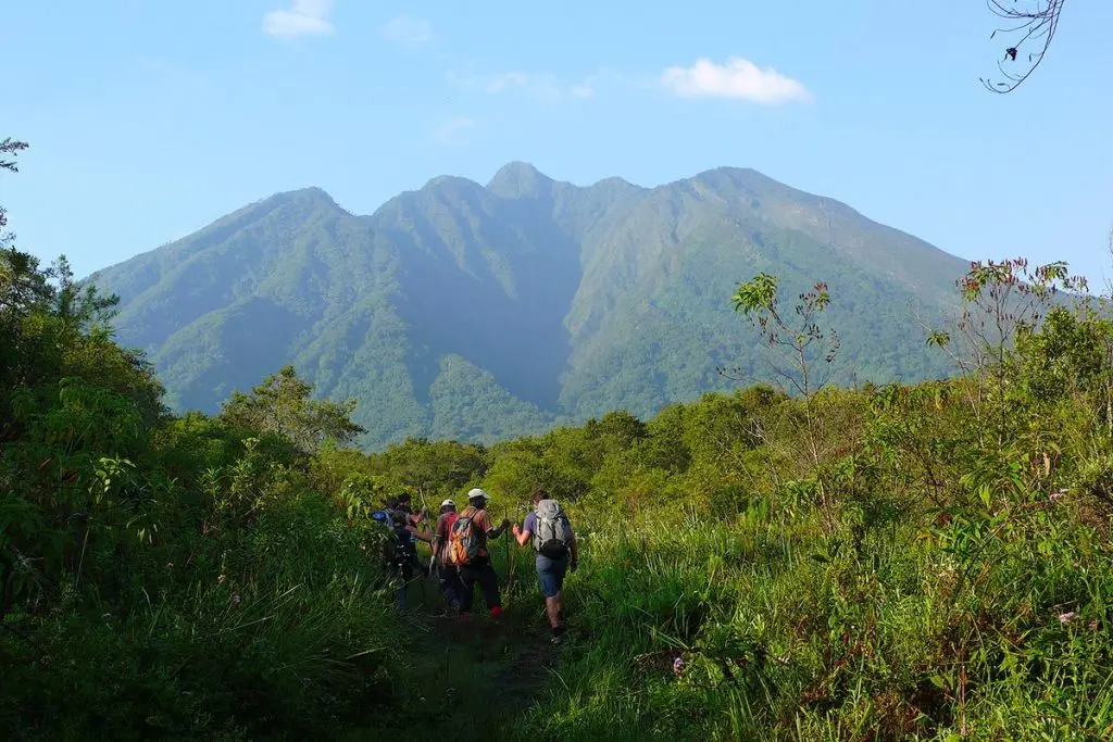
Mount Elgon
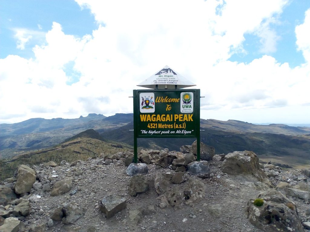
Mountain Elgon is an extinct volcano in the eastern portion of Uganda, near the Kenya-Uganda border, with a surface area of 50 km by 80 and a series of peaks, the highest of which is the Wagagai peak at 4,321m (14,178 feet). Its extrusions span 1,250 square miles (3,200 square kilometers) and are primarily made up of fragmented rocks and some lava rocks. This mountain is split by Uganda and Kenya, but its highest peak is utterly in Uganda, in the country’s eastern region, not far from Mbale town. Mount Elgon is the second-highest mountain in Uganda and is thought to have last erupted over 24 million years ago, making it the oldest and one of the world’s largest calderas.
Hiking on Mount Elgon requires no specific equipment or skill and through its several trails and it is surely a rewarding experience as hikers can ascend without many obstacles. Mount Elgon is protected by two Mount Elgon National Parks, one on either side of Uganda and Kenya respectively. Although this mountain can be hiked from either side, its highest peak Wagagai lies on the Ugandan side.
The Sipi trail, which takes about 6 to 7 days to summit to Wagagai is the longest but most rewarding of all the hiking trails on Mount Elgon. The second trail is the Piswa trail, which takes hikers through hot springs and is a great location for wildlife viewing.
The Suam trail, on the other hand, is also long; though it is the least frequently used: the trail begins at the Suam trading center on the Uganda-Kenya border and takes 4 to 5 days to reach the summit of Elgon. There is also the Sasa trail which offers the most direct route to the mountain’s Wagagai peak. This trail departs from Budadiri Town. Taking any of these trails will give hikers a new experience while climbing this mountain because they are all distinct and offer various beautiful vistas.
A range of wild animals including the African bush elephants, small antelopes, duikers, monkeys, Elgon shrew, and Thomas’s pygmy mouse can be seen during hiking trips up this mountain. There are also several rare bird species, such as the Sharpe’s longclaw, hunter’s cisticola, Jackson’s spurfowl, and Elgon francolin. One of its noteworthy features is its flora, which includes several uncommon species on the mountain slopes, such as Ardisiandra Wettsteinii, Carduus Afromontanus, and Echinops Hoehnell among others.
Besides experiencing incredible wildlife and scenery, you’ll also learn about one of Uganda’s unique cultures, the Bagisu/Bamasaba culture while hiking Mount Elgon. These people have distinctive cultural traditions, such as the annual circumcisions that take place in this area. During these ceremonies, cultural dances called imbalu are performed while escorting young people who will be undergoing these practices.
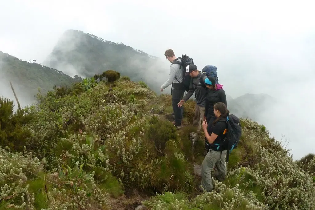
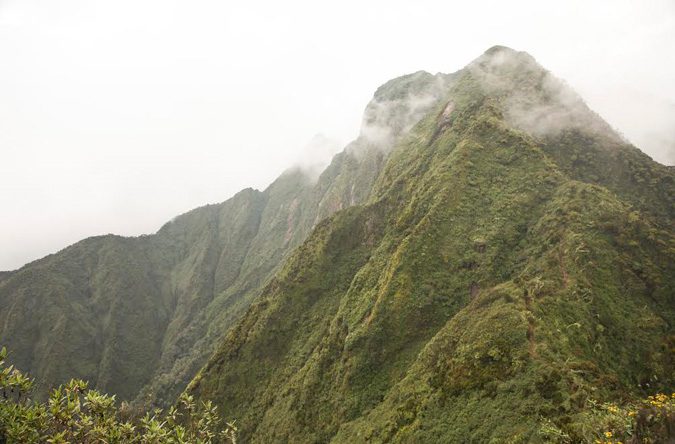
The Virunga Mountains in Uganda.
Mountain Muhabura
This dormant volcano in the Virunga mountains is located on the Uganda-Rwanda border. At 4,127m (13,540 ft), Mount Muhabura is the third highest of the eight Virunga Mountains located in the Albertine rift. The Virunga Mountains span the borders of Uganda, Rwanda, and the Democratic Republic of Congo. Mount Muhabura may be hiked from either side and is shared by Uganda and Rwanda. On a clear day without rain, climbing this mountain will take eight hours and involve a 12-kilometer round journey.
The reward is the spectacular views of the Virunga Mountain ranges. Out of these Virunga ranges, Mountain Muhavura is the most frequently ascended mountain, and on the Ugandan side, hiking tours on this volcano start inside Mgahinga Gorilla National Park.

Mount Muhavura is shaped like a cone and covered in volcanic ash from earlier eruptions. The hikers will have a clear view of the lush greenery on the mountain’s slopes as they rise, and the entire journey may be completed in a single day. Moreover, hiking up and down this mountain will give you a once-in-a-lifetime opportunity to co-exist with creatures like mountain gorillas on a lucky day, elephants, buffaloes, monkeys, and endangered bird species.
With the aid of a pair of binoculars for easy viewing, walking sticks that can be used during hiking, long pants, long sleeve shirts, and a pair of good hiking boots, your Uganda hiking tour on Mount Muhavura will be a thrilling safari experience. Although Mountain Muhavura may be visited all year round, the best time to go hiking is during the dry season, which typically lasts from December to March. This will help you avoid being affected by heavy rainfall that results in slow movements and difficult trails.
Mount Sabyinyo
Mount Sabyinyo is one of the eight Virunga Volcanoes shared by Uganda Rwanda and DR. Congo. The extinct volcano is situated in Mgahinga National Park in Uganda, the Virunga National Park in the DRC, and the Volcanoes National Park in Rwanda. In Uganda, Mount Sabyinyo lies west of Lake Bunyonyi and it is elevated at 3,669m (12,037 ft).
Mount Sabyinyo is one of the most difficult mountains to hike in the Virunga Mountains with multiple ridges due to its rugged slopes and craters on the sides. The hikes are only done in Uganda since the Uganda Wildlife Authority solved the challenge by handcrafting ladders to enable hikers to reach the summit. Mount Sabyinyo offers one-day hikes with 8 hours of ascending and 4 hours of descending, depending on the hikers’ pace, weather, and other factors.
Hikes start from the park headquarters with a briefing from the rangers about the hike and what should be expected. Walking sticks are given free of charge, and porters can be hired. The hike will take you through the bamboo zone at the bottom where you will encounter a range of monkeys, elephants, buffaloes, and mountain gorillas if you are lucky. Towards the peak, you will hike through a lovely forest patch of Hagenia Hypericum and a Sub-alpine zone with fewer trees.
The picturesque Lake Kivu in Rwanda and the Democratic Republic of the Congo may be seen from the top. You will also be able to see Lake Bunyonyi, the Rwenzori Mountain ranges, and the rest of the Virunga Mountains. Whereas hiking tours on Mount Sabyinyo can be done any time of the year, the best time to visit is during the dry season, generally from December to March when hiking conditions are favorable.
Mount Gahinga
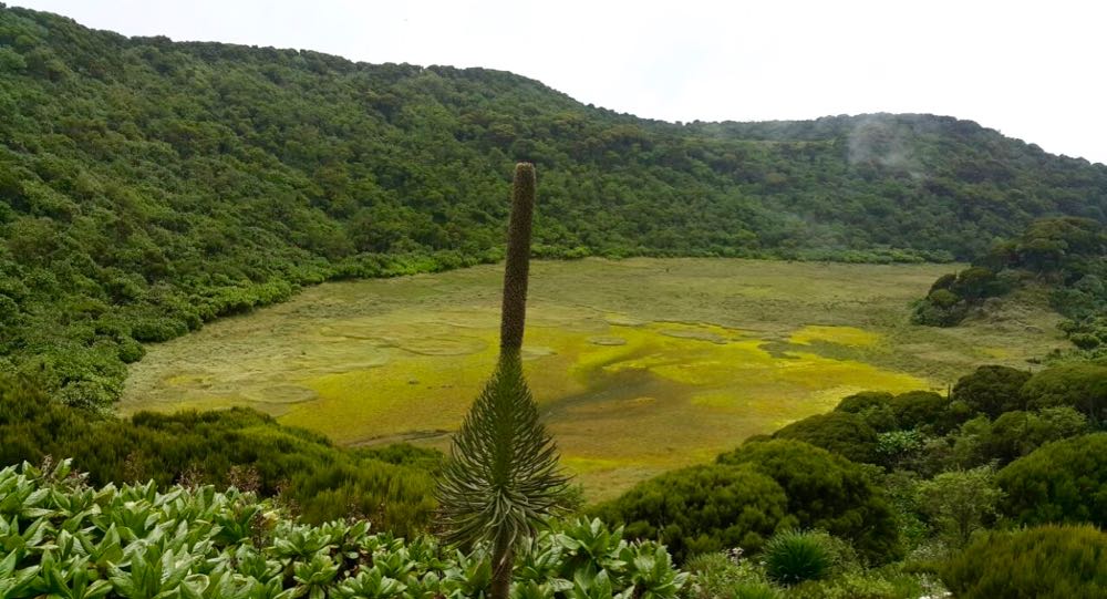
Also located in Mgahinga Gorilla National Park, this dormant volcano lies between Mount Muhabura and Mount Sabyinyo on the Uganda-Rwanda border, and it is the smallest of the three mountains. The word Gahinga in Kinyarwanda/Rufumbira translates as ”a small pile of stones,” and it is where the volcano, as well as the National Park, derive their names. Its peak contains a 180m (591ft) wide caldera that is completely submerged by marshes.
Mount Gahinga, at a height of 3,473m (11,394 ft), is one of eight Virunga volcanoes in Uganda, Rwanda, and the Democratic Republic of the Congo. The slopes of this mountain are largely occupied by bamboo forests, and the vegetation in this area is thus described as afro-montane; which is further spread along the three mountains of Muhabura, Sabyinyo, and Mgahinga. Hiking up this stunning mountain begins at the Mgahinga Gorilla National Park headquarters, where one will also have the opportunity to view the fascinating mountain gorillas. These endangered creatures have made their home on Mount Gahinga’s slopes.
If hikers are lucky, they may be able to see golden monkeys clearly as they pass through a dense bamboo forest on this six-hour ascent and descent. At the mountain’s summit, hikers will get to see the gorgeous swampy crater and views of other Virunga Ranges. The Gahinga trail, which originates in recently reclaimed farmland and extends to the pristine forest’s edge, is the most popular trail used to climb up the mountain.
The climb is comfortable when it hasn’t rained and it’s clear on a sunny day: furthermore, the landscape is breathtaking as one gets to witness the jungle animals and bird species that call this forest home. Hiking will be greatly facilitated with the aid of some gear such as walking sticks, energy-giving meals and drinking water, hiking boots, comfortable clothing, and other essentials to ensure a smooth hike. Before beginning the climb, it is crucial to check the weather because rain might make the journey difficult. Sunny days are preferable for this hike to prevent slipping and becoming stranded on muddy trails.
Mountain Morungole
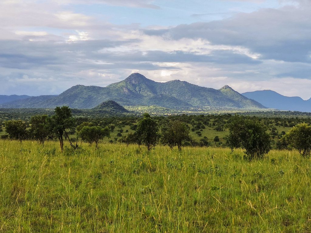
Mount Morungole is located in the Kidepo valley National park in the northeastern region of Uganda, near the border with Sudan. Towering over 2,750 meters above sea level, the mountain lies within a rural area in Karamoja. Mount Zulia, Labwor, and Dodoth Hills, three mountain ranges with a combined height of 2,000 meters, are some of the ranges that surround this mountain. Mount Morungole’s actual peak is out of bounds for travelers since it is a highly regarded place of worship for the IK people.
The Ik, a small tribe in Uganda, are said to have settled on Mount Morungole in the past. They are thought to have been drawn to this location because of their belief that the place was sacred. Uganda hiking safaris to this place are worthwhile because of the fascinating Ik people and; hiking in this place allows one to navigate around their homestead and discover their rare culture in their unique home of Mount Morungole. The IK are said to have occupied after moving from their former habitats on the plains of Kidepo Valley.
Hikers can hike up the mountain in two to three hours, depending on how steep the mountain is and how clear and uncrowded the hiking trails are. On the other hand, descending this mountain takes one and a half hours. Ascending Mount Morungole requires a guide because the majority of the Morungole trail passes through Ik homesteads, and these people can be a bit antagonistic to outsiders. However, with a guide’s assistance, this hike will be the best one, full of insights and life-long adventures.
Hikers to Mount Morungole can choose to combine their tour with a game drive in the nearby Kidepo National Park, where their wildlife anxieties will be allayed, while still enjoying the views from this summit that extend to South Sudan and Kenya in the eastern rift valley. The best time to hike this peak is during the dry season to avoid bad weather and rough hiking conditions.
Mount Moroto
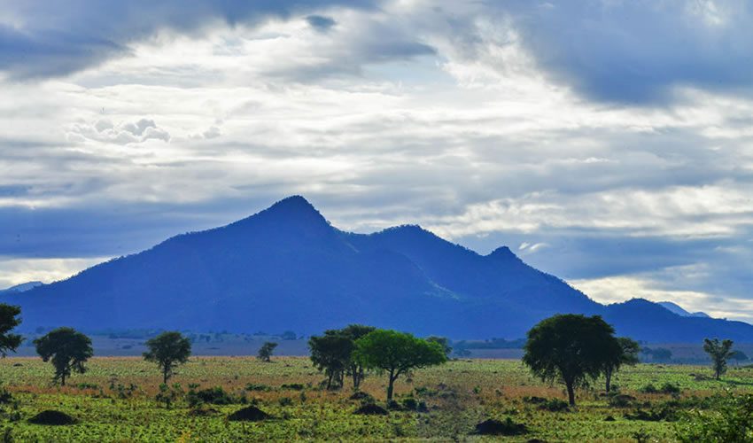
Mount Moroto is located in the northeastern portion of Uganda at a height of 3, 083m (10, 115ft). This mountain lies next to Moroto town in the Karamoja region in the northern part of Uganda. Mountain Moroto is the highest peak in the Karamoja region, and it is located on the escarpment of the Eastern Rift Valley – a chain of volcanoes that runs along Uganda’s international border with Kenya, beginning with Mt Elgon in the south and ending with Mt Kadam and Mt Morungole.
Mountain Moroto means “westward mountain” in Karamajong, referring to the mountain that the Karamajong first observed after arriving in this remote area of northern Uganda. The Tepeth, who live around this mountain are a rare culture in the world and they are pastoralists living in grass-thatched houses. Hiking on this mountain will expose you to their culture, way of dressing, language, and lifestyle which they have conserved for a long time. The Tepeth can be compared to the Maasai people of Kenya and Tanzania who are the most intriguing tribes in Africa.
Because mountain Moroto is widely accessible from Karamoja, hikers may simply ascend and descend it with the aid of a variety of paths. In just two days, one can explore the entirety of this region’s attractions. To avoid injuries from thorns on the hiking trails, hikers are advised to wear proper hiking clothing, including hiking boots, sunglasses, long, thick socks, long-sleeved shirts, and pants, as well as sunscreen to protect their skin from sunburn, especially during the hot months of December to February.
Pace yourself with plenty of water, and other equipment as recommended by the tour guides. Hiking Moroto will surely deliver the best hiking experience on East Africa Uganda hiking tours, with many discoveries made while climbing up and down this mysterious mountain and it is best hiked during the dry season.
Top Hiking Trails in Uganda
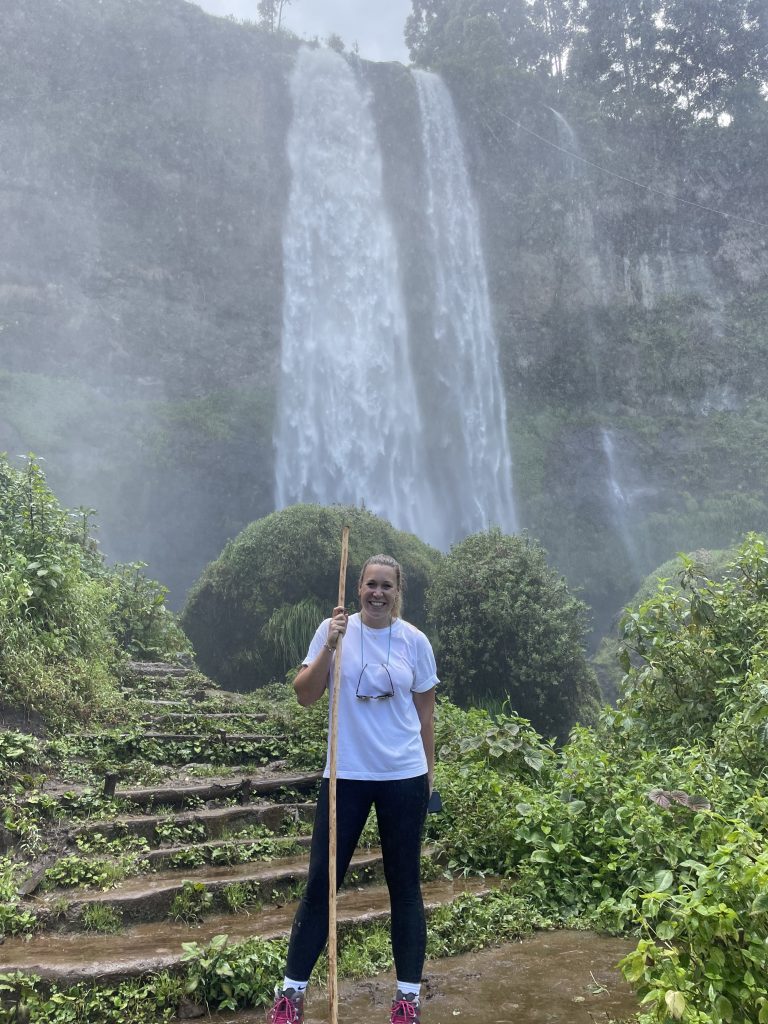
Sipi Falls Trail
The three most beautiful Sipi Falls can be found in Uganda’s eastern Kapchorwa district, along the lower slopes of Mount Elgon. These falls are thought to have been called after an indigenous plant known locally as “sep,” which resembles a wild banana and thrives along the Sipi River’s banks. This plant, which resembles a wild banana and has a transparent green color with a scarlet rib, is thought to treat fever and measles.
Sipi Falls are situated at an elevation of 1,775 meters and are the most striking tourist attraction in Mount Elgon National Park. Hiking to these falls might be challenging and muddy, but it is so gratifying to see their beauty. Following the Sipi River makes hiking simple because the trek includes touring through farmlands and nearby settlements that keep hikers interested.
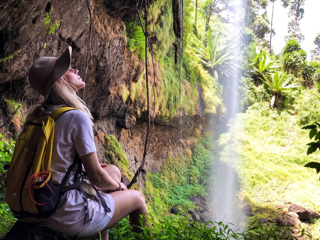
The first waterfall cascades 85 meters over a cliff, with a trail cutting behind it halfway. This first waterfall is the second highest of the three and follows the Sipi River flow from the top. It is quite scary from the bottom because of its tremendous splash, but it is more rewarding from the top since it provides a clear view of Mount Elgon. After this initial plunge, the river continues on its course through farmland, nearby communities, over rocks, small cliffs, and through rapids before finally plunging 65 meters over another large cliff to create the second and smallest of the Sipi Falls. If the hike is done on a rainy day, the shower becomes risky and hikers are advised to watch the fall from a cave behind this fall.
From there, River Sipi continues through more bushes and fewer local community farms to form the third big plunge at a cliff of 100 meters. This is the tallest and largest of all the Sipi Falls and it is large enough to provide a natural swimming pool with cold and fresh waters ready to be jumped in by swimming enthusiasts. This fall is also a popular spot for abseiling adventures: it is the most significant of them all, and when hikers encounter it, they are enthralled.
Top Forest Hiking Trails in Uganda.
Kalinzu Forest
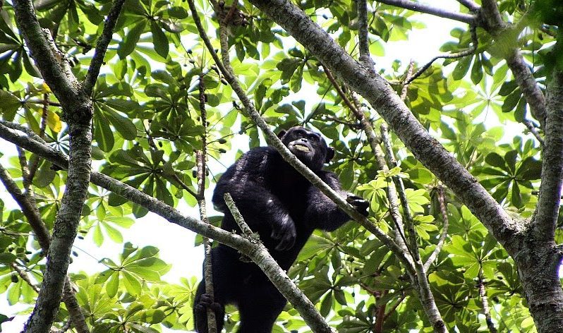
Kalinzu Forest is one of the most beautiful woodlands in western Uganda, located in Bushenyi district, approximately 375km from Kampala. Kalinzu Forest borders Queen Elizabeth National Park and the Maramagambo Forest. This forest covers an area of approximately 147 square kilometers and was primarily established to protect wildlife as it provides refuge to numerous tree species, shrubs, and a healthy number of primates such as blue monkeys, 220 chimpanzees, baboons, vervet monkeys, white colobus monkeys, over 380 bird species, more than 100 moths, reptiles, and 270 butterflies.
Because it’s possible to coexist with chimpanzees on hikes to the Kalinzu forest, this place is a place of exciting hiking adventures. The forest is home to many of these critters, making it possible for hikers to locate these chimpanzees. Most tourists find this to be the most fascinating activity. Major animal species in Kalinzu forest also include buffaloes, elephants, waterbucks, leopards, wild pigs, and lions, which can also be spotted in the protected savanna grassland side of the forest.
Hikers will be able to see the wonderful beauty of this forest by strolling through the numerous trails. There are four designated hiking trails in Kalinzu Forest, each with its distinct features. The river trail is the shortest of them all, taking about an hour to complete and it follows the river Kajojo, sometimes known as the Elephant Waterway. The trail is short but rewarding because it allows hikers to see the river Kajojo and the different tree species of the forest’s climax tree parinari excelsa: not to mention a clear view of different primates such as chimps, red-tailed monkeys, etc. Depending on the hiking pace, hikers can complete the second path, the palm tail, which is a 5-kilometer hiking trip, in as little as two hours.
The palm path gives visitors the chance to inspect many tree species, including the Raphia palm tree, which is used to weave mats, the flame tree, which is recognized for its vasts, and the red flames that resemble tulips. The waterfall route, on the other hand, is an 11-kilometer hike that takes four to five hours and provides views of the spectacular Kilyantama waterfall.
The trail passes through mountainous terrain and a damp environment. The last trail is the valley trail, which takes two hours to hike through and has a three-and-a-half-circular loop with the most fascinating nature. This trail includes hiking along ridges that eventually give a satisfying view of the steep, deep valley and the Mutragyne rubrostipuleta, a tree species that is commonly known as the “Viagra tree” because it increases sexual performance.
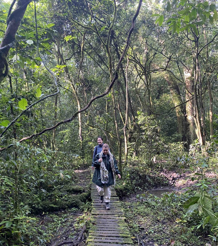
Hiking Trails in Bwindi Impenetrable Forest
Bwindi Impenetrable Forest is a vast primeval forest situated on the western branch of the East African rift at elevations of 1,160 to 2,607 meters (3,806 to 8,553 feet) in southwestern Uganda’s Kanungu District. Protected as Bwindi Impenetrable Forest National Park, the forest is home to half of the world’s population of Mountain Gorillas, Uganda’s most popular tourist attraction. The runyakitara word Mubwindi, which means a “place full of darkness,” is the source of the forest’s name.
Aside from mountain gorillas, there are many other primates there, including blue monkeys, vervet monkeys, red-tailed monkeys, and L’Hoest’s monkeys. Bwindi Impenetrable Forest is also home to around 120 mammal species, including forest elephants and yellow-backed duikers, 348 bird species, including Albertine Rift endemics, 220 butterfly species, and a variety of reptile, as well as amphibian species.
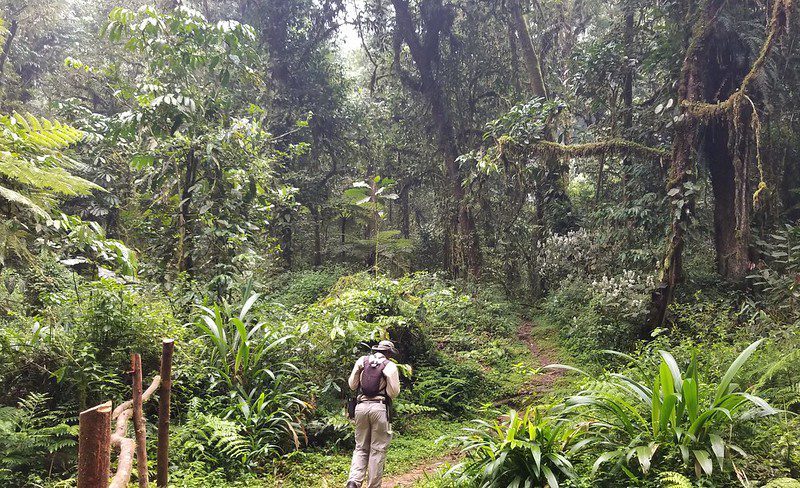
Several accessible and worthwhile hiking trails may be used to hike into the dense forest of Bwindi. The first trail is the Kashasha River trail, a 4to 5-hour trail that leads through the 600-meter-high Buhoma-Nkuringo route’s severe inclines. The walk begins either in the Buhoma sector or Nkuringo sector and travels past a junction of two rivers before venturing deeper into the forest, where hikers can witness a variety of bird and animal species.
The second trail is the bamboo trail, which will take hikers 7 hours to hike up a steep hike of 2,607 meters above sea level, the highest point of the forest. While at the top, hikers will have a clear view of Lake Bunyonyi, the beautiful spectacular Virunga volcanoes, and the park at large. The bamboo trail is rated the best hiking route.
The Mubwindi Swamp Trail. This 4 to 5-hour trail offers spectacular views of the beautiful Virunga massifs as it winds through the jungles and slopes of the ancient rainforest. Because this trail is well-known for being a habitat for a lot of species, hikers will likely come across several bird species, mountain gorillas, elephants, and bushbucks, to mention but a few.
Muzabajiro Loop trail
This trail ascends the forest to Rukubira Hill in 3 to 4 hours and affords a clear view of the Bwindi impenetrable forest, the enormous rift valley, and the majestic Virunga Mountains. It is located in the Buhoma sector of Bwindi Impenetrable Forest National Park.
The Habinyanja trail
This trail follows the Munyanga River on the steep slopes of the Habigorogoro and Riyoyi peaks, which overlook the Buhoma River. It takes 4 to 6 hours to complete and offers the best views of many bird and tree species.
The Ivy Trail
This 14 km hiking trail, which can be completed in a full day, offers hikers the chance to see a variety of local wildlife, tree species, and insects as they go about their daily lives. The trail can be accessed from either Buhoma or Nkuringo sector, and it is not strenuous at all.

Rushura Hill Trail
The highest point in Buhoma is Rushura Hill. The Rushura trail begins at the Buhoma Park headquarters and travelers proceed through the forested areas. From the top of this hill, hikers are rewarded with stunning views of Mount Rwenzori, the majestic Virungas, and a clear perspective of the dense forest, making it such a worthwhile walk.
Munyanga Water Trail
This trail begins along Buhoma and continues along the ivy river to Nkuringo. While hiking here, one may see three 33-meter-high waterfalls as well as a variety of creatures, including birds, monkeys, orchids, and lovely butterflies. This is the most convenient trail for hikers who are in a hurry.
Uganda hiking tours to Bwindi take place all year long, and for those who enjoy gorilla trekking, this is the best location for them. In addition, Bwindi Impenetrable Forest National Park is located within this mighty forest, making it the best location for anyone considering hiking. This is because the forest is home to a variety of wild animals and bird species that are all protected there.
The Batwa Cultural Trail in Mgahinga Gorilla National Park
The Batwa cultural trail is one of the most Uganda cultural tours and hiking tours offered in Mgahinga Gorilla National Park. The trail is a 5-hour trail exposing tourists to the unique cultural heritage of Uganda’s indigenous tribe – the Batwa. The Batwa are indigenous African pygmies who lived in the Bwindi impenetrable and Mgahinga tropical rainforests thousands of years ago before they were designated as national parks. The Batwa also known as the “Twa,” were fruit gatherers and hunters, who depended on these forests for food, shelter, and medicine.
They were regarded as the poorest people in the world, with a short life span, 1.5m in height, and numerous newborn mortalities. The Batwa culture began to fade after the Bwindi and Mgahinga forests were designated as national parks because of the government’s need to protect the endangered mountain gorillas. The Batwa were then forced to live in settlement camps outside the parks, causing them to lose their skills and tools that were no longer in use.
Failing to adapt to the new life, most of them resorted to stealing, drinking alcohol, poverty, and being lethargic in the areas they lived. After a long period of suffering, these people began to vanish, and in 2011, Uganda Life Reunion, in collaboration with USAID and the Dutch embassy in Kampala, launched the Batwa culture trail, which is located in Mgahinga Gorilla National Park. This was launched to improve the livelihoods of the Batwa communities. Hikes on the Batwa cultural trail are accompanied by cultural discoveries as hikers are led through the dense forest by Batwa residents, which are defined by old gathering and hunting lessons.
Aside from this, there are other fascinating activities to keep hikers interested while here, such as gorilla trekking, cave exploration, and other Batwa cultural traditions. Moreover, a village visit program and the Buninga Batwa forest walk were established by the international gorilla conservation program in the south end of Bwindi Forest: these have provided hikers who go hiking here with the opportunity to explore more knowledge about the Batwa culture and traditional ways.
Kibale Forest Trail
Western Uganda is home to this fine rainforest, which is green and damp. This 12-kilometer-long forest, which includes both lowland and montane planks of wood, is home to the last significant portion of the pre-montane forest. It was created in 1993 to save a sizable forest tract that would later be designated as a national park called Kibale Forest National Park. Queen Elizabeth National Park, which is a continuous forest that serves as a wildlife corridor, is located south of this forest.
Kibale Forest is an ecotourism and safari destination because of its famous habituated chimpanzees and twelve other primate species such as the red colobus monkey, and the L’Hoest’s money, among others. Kibale is also home to 69 mammal species, 372 recorded bird species, and a variety of butterflies, reptiles, and amphibians. Hikers will enjoy nature hikes, chimpanzee trekking, and bird watching, making this a wonderful excursion for hikers.
Hikes in Kibale Forest start from Kanyanchu Tourism Center or Sebitoli and are open all year round, although hiking here is best in the dry season when the routes are clear and make for easy travel. Typically, the dry seasons last from December to February and then again from June to September.
Popular hiking trails in Kibale Forest include the forest trail and the Bigodi Swamp walk which takes hikers through the gorgeous Bigodi wetland and Bigodi local community. Bigodi is one of Uganda’s ecologically diverse wetlands teeming with a variety of birds and aquatic animals. The nocturnal forest walk is also an interesting hike in Kibale that takes hikers in search of nocturnal wildlife. Finally, the top of the world trail, a 3-hour trail that takes hikers through villages, farmlands, and the crater lakes region.
Mpanga Forest
This is a forest in Uganda consisting of natural tropical rainforest totaling 453 hectares (1,120 acres) in Mpambire, Mpigi district, 37 kilometers southwest of the capital city. Mpanga Forest boasts about 500 species of trees and shrubs that are said to be over 100 years old.
This woodland is further home to 300 bird species, both common and rare, and some of these include the hornbill, spotted Greenbul, and Ross turaco. There are also over 97 butterflies, 112 months, and a variety of mammals including three monkey species, such as red-tailed and bush back monkeys, which may be seen when hiking in this forest. Hiking in Mpanga Forest is perfect because of its several hiking trails that offer unique and beautiful sceneries and these include;
The Hornbill Trail
This trail is unquestionably the best hiking trail in the forest since it offers hikers the chance to witness monkeys, butterflies, rolling hills, fungi, birdlike buttresses, and more. Hiking via this trail takes 3 hours.
The Baseline Trail
Hikers can enjoy views of the forest canopy and neighboring settlements from this hiking trail. Hiking here provides a clear view of the butterflies and bird species, and other sports such as riding may be done while here, and the trail terminates at the papyrus swam
The Butterfly Trail
Taking 30 minutes, you may complete this 1-kilometer trail. This trail is well-known for being the greatest place to see mammals like red-tailed monkeys and bush babies, and it is also praised for its excellent vistas of many types of vegetation. Mpanga forest is without a doubt the best area to go hiking in Uganda because of its conveniently accessible position and the forest’s rich flora and fauna, and hiking here is done all year round.
Kyambura Gorge
The Kyambura Gorge is situated 11 kilometers from the Kazinga Channel on the northeastern edge of Queen Elizabeth National Park, at the northern border of the Kyambura Game Reserve. In comparison to other reserves, this place is thought to be where one may discover the most chimpanzees in Queen Elizabeth. It is a hike-worthy subterranean rainforest flanked by tumbling cliffs and dry savanna. In addition to having large crater lakes, unobstructed forest canopy, 100-meter-high rocks, thick jungles, boggy swamps, and breathtaking views of the Mount Rwenzori ranges, this location is well-reserved and appears unaltered, making it a worthwhile stop for hikers on their Uganda hiking tours. The Kyambura Gorge is well-known for its distinctive landscape, which provides a great refuge for chimpanzees and other animals like antelopes, hippos, and hyenas as well as other bird species.
