DISCOVER UGANDA
Mountaineering in Uganda
Mountaineering in Uganda gets tourists exploring some of the most remarkable mountains in Uganda including the Rwenzori Mountain Ranges, Mount Elgon, Mount Moroto, and the Virunga Volcanoes in Mgahinga Gorilla National Park, to mention but a few.
Boasting some of the most panoramic volcanoes and mountains, Uganda is one of the best safari locations in Africa to go for mountaineering adventures. Mountaineering in Uganda gets tourists exploring some of the most remarkable mountains in Uganda including the Rwenzori Mountain Ranges, Mount Elgon, Mount Moroto, and the Virunga Volcanoes (Mount Gahinga, Mount Sabyinyo, and Mount Muhabura) in Mgahinga Gorilla National Park, to mention but a few.
From short to lengthy mountain hikes, mountaineering safaris in Uganda are designed to suit all hikers’ interests. Besides the thrilling adventure of conquering summits and ticking mountains off the bucket list, mountaineering in Uganda reward visitors with up close and personal encounters with wildlife, stunning flora, and local villages. Below are the best locations to go for mountaineering in Uganda;
The Rwenzori Mountains Ranges
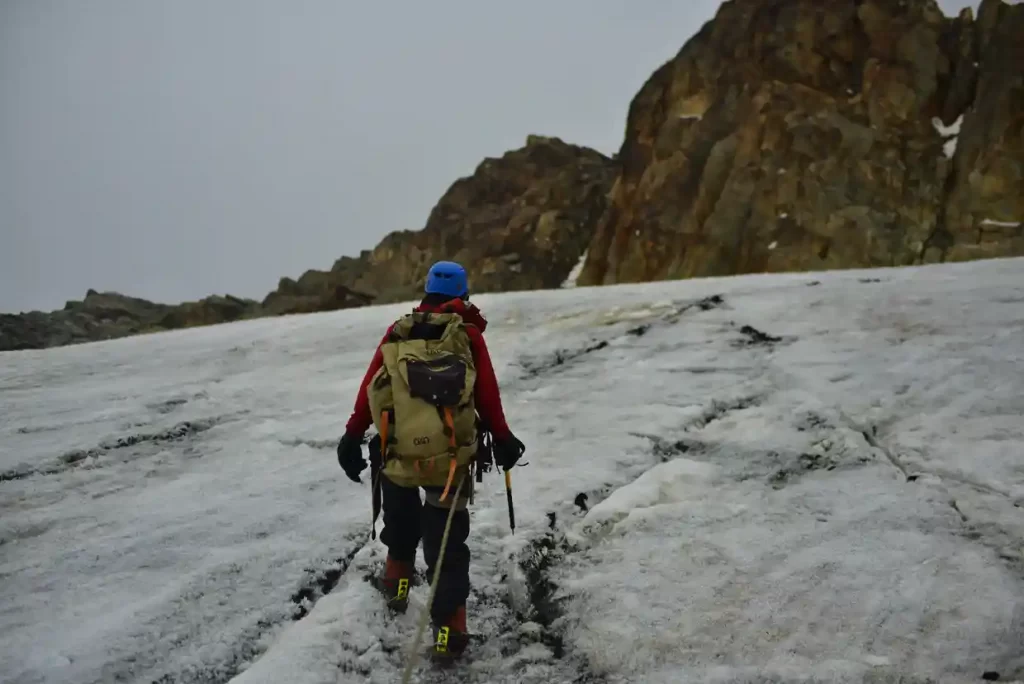
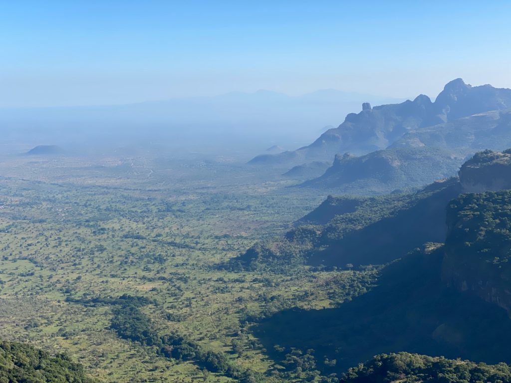
Located in southwestern Uganda along the border with the Democratic Republic of Congo, the Rwenzori Mountain ranges are a chain of block mountains that span 120 kilometers in length and 65 kilometers in width. The Rwenzori Mountains consist of six massifs separated by gorges with Mount Stanley’s Margherita peak being the tallest at 5,109 meters and the third tallest in Africa. The Rwenzori Mountain Ranges are one of the few mountains in Africa that are snow-capped throughout the year. Other massifs include Mount Speke (4,890m), Mount Baker (4,843m), Mount Emin (4,798m), Mount Gessi (4,715m), and Mount Luigi di Savoia (4,627m).
Managed by the Uganda Wildlife Authority, the Rwenzori Mountain Ranges are protected under the Rwenzori Mountains National Park, which is the premier mountaineering destination in Uganda. Hiking the Rwenzori Mountains offers enthralling experiences that allow hikers to explore one of the largest mountain ranges on the globe. The ranges encompass diverse flora, attractive lakes, rivers, waterfalls, and breathtaking glaciers, as well as a variety of wildlife and bird species. The Rwenzori Mountain Ranges were once ranked the best in Africa and ninth in the world for the best mountaineering expeditions boasting magnificent beauty and challenging, yet gratifying hiking adventures.
Mountaineering trips to the Rwenzori Mountains peak are provided with two hiking trails. The first trail is the central circuit which is also the longest trail is an 8 to 9-day hike and allows ascending to the Margherita peak. However, the central circuit is joined by the southern circuit at River Mubuku, which also proceeds to the Nyamwamba Valley above Kilembe near Kasese. The other trail is the 7-day Kilembe Trail which is operated by the Rwenzori Trekking Services (RTS). Other shorter trails that offer the best of the Rwenzori Mountains include the 3-day Mahoma trail and the 1-day chimpanzee trail. The Rwenzori Mountains are accessible any time of the year for mountaineering tours; nonetheless, they are best visited during the dry season from June to September and December through February, when the hiking conditions are favorable.
Mount Elgon
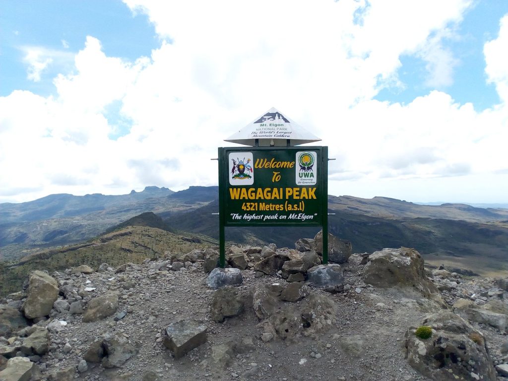
Seated on Uganda’s border with Kenya, Mount Elgon is an extinct volcano located in Eastern Uganda. Though shared by Uganda and Kenya, its highest point, Wagagai elevated at 4,321 meters above sea level is located on the Ugandan side. Protected by the Mount Elgon National Park, Mount Elgon is one of the world’s largest calderas and oldest single mountains, delivering some of the most rewarding mountaineering experiences. At the extinct volcano’s base Mount Elgon National Park is home to a spectacular montane forest that thrives with elephants, buffalo, monkeys, baboons, and other creatures populating the lower slopes.
Mount Elgon National Park is also home to over 300 recorded bird species and its upper elevations provide a haven for spectacular vegetation. Mount Elgon is one of the best mountains to hike in Uganda because it features easy hikes filled with rewarding views of wildlife and varied vegetation zones with stunning features such as waterfalls, caves, local farmlands, etc. Unlike other Uganda mountaineering trails, Mount Elgon does not require any expert skills and gear to ascend to its peak. On the Ugandan side, there are three distinct trailheads offered on Mount Elgon Mountaineering tours, all varying in length and difficulty: the Sasa trail, which is also the original trailhead to Wagagai is the shortest, yet most challenging hiking trail.
The trail is a 4-day hike and starts from Budadiri town. Starting from the northern side of the mountain in Kapkwata village, the Piswa trail is the longest trail taking 7 days to complete. The last trail is the Sipi Trail which is a 4-to-6-day hike that embarks from the Forest Exploration Center, near Sipi Falls. This trail is the most fascinating, offering breathtaking views of Sipi Falls, the Karamoja Plains, and the far-reaching Lake Kyoga. While Mount Elgon is accessible at any time of the year, the best time to go mountaineering here is between June to August and December to March.
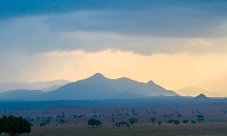
The Virunga Volcanic Ranges
Well known for providing the last remaining habitat of the world’s remaining population of mountain gorillas, the Virunga Volcanic Ranges are a chain of volcanic mountains that spread across eastern and Central Africa along the borders of Uganda, Rwanda, and the Democratic Republic of Congo. The Virungas are made up of eight volcanic mountains, three of which are found in Uganda’s Mgahinga Gorilla National Park, and these include Mount Gahinga, Mount Sabyinyo, and Mount Muhabura/Muhavura.
Mount Muhabura
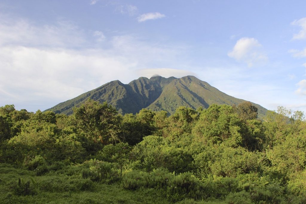
Shared by Rwanda and Uganda, Mount Muhabura, sometimes called Muhavura is the third tallest of the Virunga mountains standing at 4,127 meters above sea level. Nonetheless, the extinct volcano is not easy to hike, considering its steepness. In the local language, Muhabura means “the guide,” and it is located near Mount Sabyinyo and Mount Gahinga. Together, these mountains form the Mgahinga Gorilla National Park. Mountaineering on Mount Muhabura is a 1-day hiking experience that starts from the park headquarters in Ntebeko and lasts about 7 hours to complete.
With its cone-like shape, Mount Muhabura features volcanic ash which harbors a range of foliage and thickets from the base and on its slopes. and at its summit, a gorgeous crater lake. With an experienced hiking guide, hikers will be treated to impressive views of rare species such as mountain gorillas, golden monkeys, elephants, buffaloes, golden monkeys, and an array of Albertine bird species.

Mount Sabyinyo
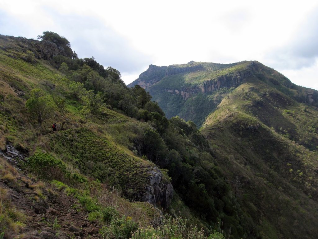
Mount Sabyinyo is the oldest Virunga Volcano range located northeast of Lake Kivu in Rwanda and west of Lake Bunyonyi in Uganda in Mgahinga Gorilla National Park. Mount Sabyinyo marks the borders between the three countries, Rwanda, Uganda, and DR. Congo and it derives its name from a local nickname, “old man’s teeth,” following its summit that resembles worn-out teeth.
Standing at 3,669 meters above sea level, Mount Sabyinyo offers thrilling 1-day mountaineering trips with spectacular views of Mgahinga Gorilla National Park and the entire Virunga Massif at its summit. Mount Sabyinyo is known as the hardest volcano to hike and can only be hiked from Uganda since the Uganda Wildlife Authority managed to establish a safe trail with handcrafted ladders to allow hikers to summit its steep slopes. All hikes up this beautiful volcano begin from the park headquarters in Mgahinga and the trek takes about 8 hours to ascend and descend.
Mount Gahinga
Also hiked from Mgahinga Gorilla National Park, Mount Gahinga is the smallest of the Virunga Volcanic Ranges, elevated at 3,474 meters above sea level. At its summit, the volcano features a swampy caldera, spanning over 180 meters in width. Mount Gahinga, which derives its name from a local term that means, “pile of stones,” is the easiest volcano to hike in Mgahinga Gorilla National Park; thus is the most preferred for many hikers. Hiking Mount Gahinga lasts between 6 to 8 hours and starts from the park headquarters with a briefing from the park wardens.
The Virunga Volcanoes offers some of the most fascinating mountaineering safaris in Uganda and after Mount Rwenzori, they are the most popular and sought-after mountaineering destinations. These Virunga Volcanoes, located in south-western Uganda are accessible at any time of the year. Still, they are best hiked during the dry months of July, August, and September.

Mount Moroto
Located in northeastern Uganda, Mount Moroto is the highest mountain in the Karamoja region, elevated at 3,083 meters. The mountain derives its name from the local word, “Moru To” which means, ‘the western mountain.” This name originated from the Karamojong who saw it in the west during their migration to Uganda. Lying in the eastern arm of the Great Rift Valley, Mount Moroto is inhabited by the Tepeth – a group of nomadic pastoralists who live in thatched huts. Mountaineering on this mountain will allow you to explore the native lives of these people; in addition to exploring the stunning summiting its highest peak – Sokodek. Climbing Mount Moroto is a 3-day hike that features trekking through lovely forest cover, amidst incredible views of the Rift Valley’s plains and ridges. Mount Moroto is best visited in the dry season from October through April.
Mount Kadam
Also located in the Karamoja region near the northeastern border with Kenya, Mount Kadam is well-known for its source of fruits, vegetables, and herbal medicine for the surrounding tribes which include the Tepeth, Sebei, Pokot, Kadama, and Pian-clan. With an elevation of 3,063 meters above sea level, hiking this mountain takes 2 to 3 days and starts from Nakapiripiti town. Moreover, the first day of your hike involves a cultural experience – trekking through authentic villages and interacting with the local tribes. Otherwise, expect spectacular views of lush vegetation, forest, and the surrounding areas. Like Mount Moroto, Mount Kadam is best visited during the dry season from October through April.
Mount Morungole
Also known as the home of the Ik tribe, Mount Morungole is the most popular mountain in the northern region of Uganda. At 2,750 meters, the mountain lies within Kidepo Valley National Park – a top safari destination in Uganda, in Karamoja. Featuring fascinating rugged landscapes, its slopes are inhabited by the Ik people – a fascinating group of people to visit. Its summit is considered a place of immense cultural significance to the Ik community and is out of bounds for visitors. However, hikers are free to explore alternative peaks which offer magnificent views of Kidepo. Otherwise, hiking this mountain is a 1-day cultural escapade that takes hikers to explore the way of life of these traditional bee-keepers and Uganda’s smallest tribe. December through March is the best time to go mountaineering on Mount Morungole.
